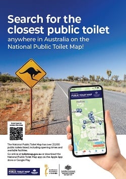
What is the National Public Toilet Map?
Where can I access the National Public Toilet Map?
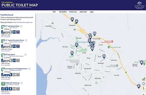
What features are available on the National Public Toilet Map?
What are some tips for travelling with incontinence?
Download promotional resources for the National Public Toilet Map
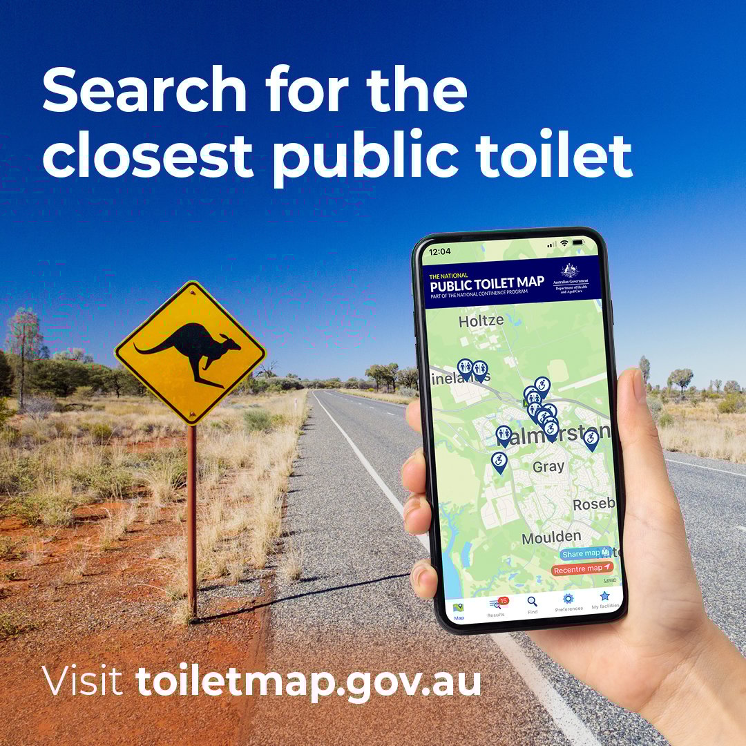
What is the National Public Toilet Map?
The National Public Toilet Map provides:
- The location of the nearest public toilet
- Details of opening hours, accessibility, parking and many other features
- The ability to add and update public toilets and their facilities
- Specialty maps, with the ability to share maps
- Distance by route, which calculates and displays the travel distance to facilities. This takes into account one-way streets and access to buildings, whether on foot or in a car.
The National Public Toilet Map is funded by the Australian Government Department of Health and Aged Care as part of the National Continence Program.
What features are available on the National Public Toilet Map?
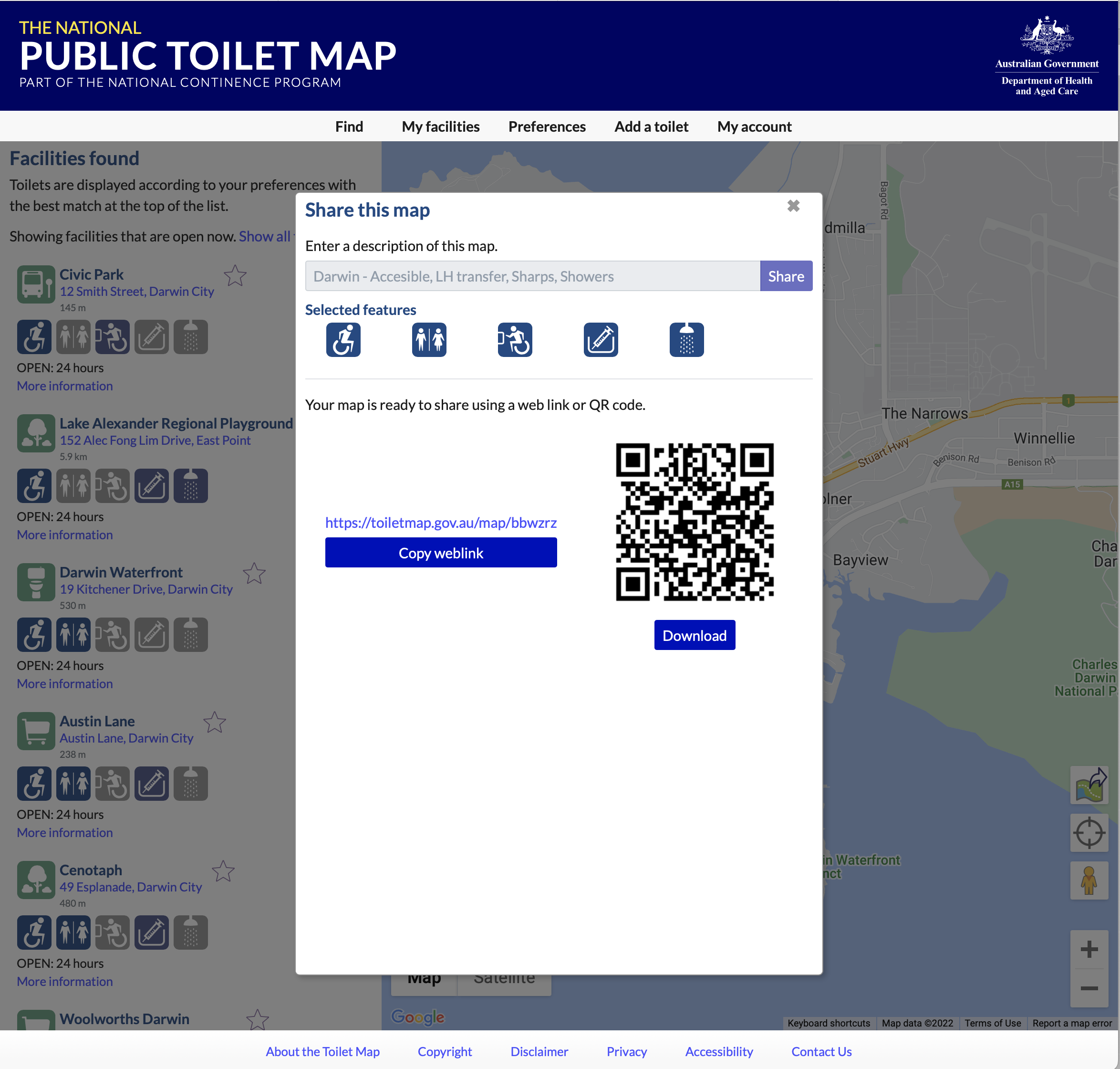
Specialty Maps
This feature allows organisations and individuals to create and share maps, based on their preferences. Specialty maps can be shared as a URL or QR Code, allowing it to be emailed, printed or shared on social media.
To share a map:
- Register or log in to toiletmap.gov.au – only registered users can create maps
- Review your preferences
- Use ‘Find’ to set the location of your map, then resize the map to cover the exact area you want
- Click on the share icon
 and add a description of the map
 - Copy the URL or download the QR Code for the map
- Add the URL or QR Code in an email, document, or social media post.
Distance by route
This feature allows individuals to calculate the quickest route to a facility, on foot or by car. This takes into account one-way streets and access to buildings.
To calculate distance by route:
- Select Find and enter your preferred location/address
- Optionally, review your preferences including whether you are on foot or in a car
- When you select a toilet, the quickest route distance will be displayed for that toilet.
Other features displayed on the National Public Toilet Map:
- Male
- Female
- All gender
- Opening times
- Adult change facilities (including shower, BYO sling)
- Baby change
- Dump point (including wash out water, afterhours access)
- Ambulant facilities
- Drinking water
- Sharps disposal
- Showers
- Sanitary, incontinence product disposal
- Right and/or left transfer – important for those with one side of the body less able
- Master Locksmiths Access Key (MLAK) The Master Locksmiths Access
Master Locksmiths Access Key
The Master Locksmiths Access Key (MLAK) is a system that enables 24/7 access to public toilets for people with disability or bladder or bowel condition. The MLAK master key opens all toilet facilities equipped with the MLAK lock. People with disability or a bladder or bowel condition can order a MLAK key using the MLAK order form. Local government organisation or disability service providers can find out about ordering MLAK keys.
What are some tips for travelling with incontinence?
Travel can be one of the joys in life, but if you’re managing incontinence, it can also be an anxious time. Planning ahead will help prevent hassles and make your trip so much more enjoyable. Read our full list of travel tips.
Resources:
We have developed a range of free resources for organisations wishing to promote the National Public Toilet Map. Please use the buttons below to download.